A hike on the Pacific Crest Trail

Hi everyone. This blog will chronicle my walk along the Pacific Crest Trail. Snoop around and find out about who I am, why I'm doing this, what I'll be bringing, and follow along as I hopefully make it all the way from Mexico to Canada.

Saturday, June 27, 2015

June 19. Day 49.

Chicken Spring Lake to Mt Whitney summit (8.5 miles from PCT mile 767).
Miles hiked: 24.7

Today was one of the most physically challenging of the trip, but also the most rewarding.

My usual sunrise hiking did not disappoint, with subtle reds and pinks in the clouds to the east and south. The trail traversed a steep talus field with foxtail pines in various stages of life and death, all twisty like an artist would hope to sculpt. As the trail rounded from the south to west side of the slope, a greater and greater panorama of mountains unfolded. Big rugged barren mountains that look like they're actively uplifting and crumbling before your eyes.


I crossed in to Sequoia National Park then dropped down into the forested slopes above a high meadow called Siberian Outpost. This is one of he great place-names of these mountains; I really wish I knew the history. 

Looking back to the south west from near the Sequoia NP boundary.

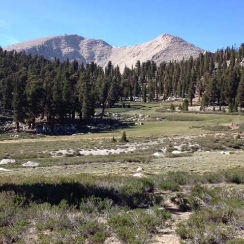
Next the trail dropped down again to Rock Creek, which flows down out of a basin walked in by some fantastically rugged terrain to the east, and what I think is just south of Mt Whitney. This looks like a really interesting little basin to explore some time.

At Rock Creek I meet Happy Feet and Coyote, and tell them about my plan to stay the night on the Whitney summit, the highest peak in the lower 48 states at 14,505 feet. But they tell me this isn't allowed, and another backpacker there agrees. Well, OK. That's fine. There are plenty other mountains to sleep on. I make some water in my frustratingly slow Sawyer mini squeeze, wet a bandana to go around my neck, then begin the climb back up out of Rock Creek toward Crabtree Meadows. I take my time, still being careful with my legs and also now not in a rush to get up Whitney. The trail climbs up a steep, thickly wooded  slope then curved into a bench with widely scattered big pine trees (Jeffrey?) and a sparse understory. It was a beautiful grove of big old trees hanging on in this little corner of the mountains. One more short climb brought me over Guyot Pass then down in to a similar bench with big views west toward the big and scary looking Kaweah peaks. 

Crabtree Meadow, looking east; Whitney is just beyond those peaks.

I was leapfrogging with Happy Feet and Coyote the next couple miles to Crabtree Meadow, and we all took a break for lunch there where the trail crosses Crabtree Creek and meets the John Muir Trail for the side trip up Whitney. They were both drinking water right from the creek, and seemed surprised that I wasn't, since the water was "clear and flowing". I pointed out that it was flowing right from perhaps one of the most heavily used wilderness areas, a place where there has been so much impact that now all human waste must be packed out, and said that filtering water seems like a pretty small cost to me (even wit my slow filter) relative to the potential risk. I happily creek untreated water in parts of the Sierra that don't get as many people, but along the PCT/JMT corridor, pretty much everything gets treated unless I see it coming out of bedrock or cascading off a thousand-foot cliff I'm pretty sure no people go up.

I had a long rest here since it was only another 4-5 miles to where I thought I'd camp, and eventually Lost and Found and Smiley showed up. These two are super friendly and happy and I like hanging out with them and the few others in their group, even though the stoney baloney is a bit thick sometimes.

Eventually around 4 I started to mosey on up he JMT along the beautiful babbling little Crabtree Creek, first following it through a big beautiful green meadow walled in by high granite peaks, then climbing as it tumbled down a narrow little wooded gully. I stopped by the ranger station in Upper Crabtree Meadow to let them know about some smoke I'd seen way out toward the Kaweahs, and ended up talking with Rob, the ranger, for about 20 minutes as he finished his laundry outside the little log cabin ranger station. The fire was old news and there's a crew there keeping an eye on things. He said he's been pleasantly surprised at how responsible the PCT hikers have been this year with minimizing impact, despite the increased number of hikers; he commended the PCTA for the good job they've done communicating the importance of Leave No Trace practices. We talked about Sierra geography and place names, then I asked him how close to the summit it was legal to camp. He replied that camping is legal all the way to the summit, but employed me to tread lightly if I chose to do so.

One creek flowing in to Guitar Lake from just north of Whitney.

With this new information I set out again with renewed ambition. I still had something like 7 miles and 3000 feet to get to the summit, and by now it was about 5. The trail continued on up the valley along the streams and trickles draining the big west-facing bowl that Whitney is the crown jewel of, and passed perfect alpine lakes with big peaks behind like I was living in a post card. I got some more water at a little tarn above Guitar Lake (many lakes in the Sierra are named for how they look from up on the peaks), chatting with a couple on the last night of a JMT section hike, then began the real climbing. The trail led up through boulders and talus toward a steep unstable looking slope punctuated with spires and pinnacles of precariously balanced granite blocks and plates. The trail followed an improbable route up this slope, seeming impossible to have been made by mere humans. I switchbacked up and up and up, struggling more and more to find enough oxygen in the thinning air, but for a time my rate of ascent was enough to match the speed of the setting sun, so that it stayed the same distance above the western peaks.

Looking back west from something like 13,000 feet.

Then sun began winning the race about the time I finished the switchbacks and made it to Trail Crest, the junction with the trail coming up from Whitney Portal. But now was when the beautiful scene I was traversing became more magical place Han I could have expected. I've spent many evenings camped in alpine valleys looking up at peaks awash in alpenglow, that special light that happens in the mountains right as the sun dips below the horizon. But this evening I was in the alpenglow! Everything around me was humming with the most incredible combination of reds, pinks and oranges. The trail now followed up the jagged saw-toothed northern ridge of Whitney, at times passing little notches where I could peer east down into the darkening emptiness of a several thousand foot straight drop toward tot Owens Valley. I was becoming a bit light headed and wobbly now with the altitude and exhaustion of the long day, and had to take a break and focus at a few aces where little patches of snow covered the trail above steep drops.

Looking back south, now at maybe 13,900; that line is the trail switchbacking up the talus.

I finally made it to the summit just as it got too dark to really walk without a headlamp. The western horizon was still glowing, and I circled the stone shelter checking out the scene before going inside to set up. There was one JMT hiker in there, and we talked a little as I set up my bed and shoveled Fritos in my mouth. After setting up I went outside again to enjoy the stars and the moment. I was feeling so alive having made the climb and arriving just at dark and just being up here in this incredible place. 


Birds:
Mountain Chickadee 
White-crowned Sparrow 
Fox Sparrow 
Oregon Junco 
Hammond's Flycatcher 
Clark's Nutcracker 
Rock Wren 
Northern Flicker 
Yellow-rumped Warbler 
Hermit Thrush
Chipping Sparrow 
Cassin's Finch 
White-breasted Nuthatch 
Townsend's Solitaire 
Brown Creeper 
Ruby-crowned Kinglet 
American Robin 

Friday, June 26, 2015

June 18. Day 48.

Death Canyon Creek to Chicken Spring Lake (PCT mile 750.8).
Miles hiked: 20


My morning routine is up to about 40 minutes now with making hot coffee and having to pack a bit more carefully around the bear can. But this is fine with me. The hot coffee is worth it, and since I get started pretty early anyway, I don't really need to rush at all to get 20 miles in a day. I'm planning on 20's at least during the early part of his leg into the mountains, which should put me on schedule to meet Libby at Vermillion Valley Resort in another 7 or so days. I may have to bump up the mileage toward the end, but my pack will be much lighter and the last 20 or so miles before VVR are fairly mellow.


This morning started with a couple miles climbing up a the shoulder of a ridge, leaving the Lodgepole Pine forest where I camped and entering into what I'm pretty sure are all Foxtail Pine, with little understory except for the occasional candy red Snow Plant poking up through the coarse sandy soil. I love being out and hiking during the sunrise, and now that I'm up into the mountains I get to watch the sun's first light start on the high cold peaks then creep down across forested slopes and finally reach the big meadows way down below.

After the climb he trail followed the ridge, alternating between circling around the steep slopes of the snaggletooth peaks that made the high points off t he ridge and crossing broad park like saddles. Once again I was on he eastern-most ridge of the mountains, and at times the view straight down to Owens Valley was dizzying. There was also an expansive view west out over what I guess is still the broad Kern River drainage. Way off to the north are high barren peaks of piled granite boulders, getting closer with each step.

Horseshoe Meadow 

After 8 miles along the ridge the trail dropped down to water at Diaz Creek. Even though I'm up in the mountains now, water is still a bit scarce and I still have to pay some attention to the water report. At Diaz Creek, a small downcut creek flowing through a little Meadow with scattered willows along the bank, I chatted some with St. Croix, Lost and Found, and Smiley, then later with Omw (pronounced Ohm, but stands for Old Man Walking), a retired man I met at Walker Pass and who I was a bit surprised had gotten this far by now. After getting water and having some lunch, I laid down to put my feet up and ended up having an hour long nap.

Just before Cottonwood Pass.

Back on trail, now climbing up toward Trail Peak and some side trails that head down to Horseshoe Meadow and one possible exit for resupply in Lone Pine. At one of these junctions I saw 2 women with horses, and ended up getting to do some professional networking. It turns out one is a fisheries biologist for the Forest Service, and they were out for he day to evaluate how much grass was in the Meadow before letting cows in. We talked a bit about how grazing in the NF is managed, and she said they often hire summer biologists and gave me her name and number. Totally productive day!

The trail wound around the east side of Trail Peak, with great views down into Horseshoe Meadow and Up to some high dome shaped peaked just to the morn but which are off my map. Then it wrapped around the west side of a steeply sloping hillside, passing beautiful hanging meadows every mile or so, before finally reaching Chicken Spring Lake nestled in under the high steep walls of Cirque  Peak. Just before the lake I heard what I'm pretty sure was a Ruby-crowned Kinglet singing. Apparently they do breed in the Sierra, but according to the Sibley range map this is perhaps just a bit south of their summer range.

 I was semi-planning to just eat dinner then do a few more miles to make tomorrow's climb up Mt Whitney a bit shorter. But the last couple miles to the lake I got pretty tired, and just ended up staying here for the night. As I ate, more and more hikers showed up, seemingly popping out of boulders or something since I didn't camp with many of them last night and didn't see them today. Turns out most of them just got back on he trail after Lone Pine. I met some new hikers: Saint Nic, Super 8, Trampon, Benjamin, Spoon, Dannis the Mannis, and a couple others. As hiker voices trailed off in the growing darkness, frogs in the lake and Common Nighthawks overhead took their place.

Birds:
Northern Pygmy Owl
Oregon Junco 
American Robin 
Hammond's Flycatcher 
Fox Sparrow 
Northern Flicker 
Western Bluebird 
White-breasted Nuthatch 
Stellar's Jay 
Yellow-rumped Warbler 
Mountain Chickadee 
Rock Wren 
Hermit Thrush
Brown Creeper 
White-crowned Sparrow 
Mountain Bluebird 
Ruby-crowned Kinglet 
Wilson's Warbler

June 17. Day 47.

PCT mile 708.2 to Death Canyon Creek (mile 730.8).
Miles hiked: 22.6.

Don't worry, the place I'm camped is much nicer than it sounds.

Took a little extra time to get hiking this morning trying to figure out a way to have better padding between me and the bear can* in backpack. With the bear can and 9 days of food my pack is just about maxed out in terms of volume and comfortable weight. There isn't quite enough padding against my tailbone, so I fiddled around a while getting my sleeping pad arranged to provide more cushion.

Once I got hiking, the trail climbed up the gradual canyon of a side creek to the Kern River. After a few miles this canyon widened into a sloping Meadow, and I saw my first bear of the trip there, ambling along eating grass like some big mountain cow. 


The canyon narrowed again and continued for another couple miles before spilling me out into one of the most magnificent Sierra meadows I've ever seen. Called Becks Meadow, this was an arm of a broad section of the valley the Kern runs through. It was 3 or 4 miles long and a third of a mile wide, with sloping forested hills rising all around. Sage grew along the upper edges, and grass and sedges were down in the lowest areas. It was just a huge wide open space with just one little farm cabin or something tucked up along one side. The trail went along the edge for a mile or so then climbed up and over a little hill to I guess avoid someone's grazing lease. From up on the hill I could see a herd of cows standing along the banks of he Kern, in the water that I was about to go drink. 

Beck Meadow 

Dropping back down into the main Kern valley, the scene just kept getting better. This was a bigger valley/Meadow with excellent high sagebrush country hills rising up to the east. I reached the river and sat under the bridge where several hundred Cliff Swallows were busy building their nests. Easy and Unicorn showed up and we brunches together and I got to tell them about the swallows and also about the Killdeer wandering along the river and the Mountain Bluebird perched on the bridge.

The three of us headed out from there together, the trail now climbing up out of the Kern Valley on a tributary canyon. By now it was starting to warm up a bit, but nothing like at lower elevations. The sun was intense, but it was still plenty comfortable in the shade and a little chilly when the wind blew. This canyon led up the southern flanks of Olancha Peak, which is just over 12000 feet tall. After a brief siesta near the top of this canyon, where I saw the first Marmot of the trip, the trail contoured around the steep east face of the mountain, then wrapped down around the northern ridge toward a small east-west pass. The habitat was park like Lodgepole Pine and occasional firs of some sort. As I approached that pass, I heard the approach of a fighter jet, which we've been hearing on and off for a week or so, and looked up just in time to see it go streaking through the pass, seemingly only a couple hundred feet above the trees and big granite boulders.

Beautiful hanging valley.

Down in this pass, which is really better described as a broad saddle, there were beautiful big boulders and fins and wind eroded pinnacles of granite scattered among the forest. I passed a few more meadows as the sun began sinking and casting long shadows and beams of light through the forest.

Headin' up thataway.

Reached camp just about sunset and found a 8 or so other hikers there hanging g out and setting up. We ate dinner together, up above camp amongst some boulders of various size, joking about rotten sausages in people's food bags and walking big miles in socks and flip-flops, while the alpenglow blazed on the ridge above us.

*In case anyone is t familiar with bear cans, they are plastic or carbon fiber cylinders that are bear proof. Bears getting people food has become a big problem in several parts of the Sierra. When bears learn that backpackers can be a source of easy food, they have the tendency to become very habituated to being around humans and may become aggressive. This can result in very unhappy encounters between people and bears, and may lead to bears needing to be shot. For the next few hundred miles through the high Sierra, bear cans are required for anyone making overnight trips. Many thru hikers complain about being forced to carry the extra weight (about 2 pounds), but I think this is sound management policy. I think it's good for the parks to be trying to prevent a problem from occurring, rather than just fixing it once it does.

Birds:
Stellar's Jay 
Bushtit 
Northern Flicker 
House Wren 
Rock Wren 
Pinyon Jay 
Western Scrub-jay 
Black-headed Grosbeak 
Spotted Towhee 
Mountain Chickadee - quick double note on cheese 
Oregon Junco 
Pygmy Nuthatch 
Lazuli Bunting 
Western Bluebird 
Olive-sided Flycatcher 
House Finch 
American Robin 
Clark's Nutcracker 
Green-tailed Towhee 
Common Raven 
Western Meadowlark 
Cassin's Finch 
Brown Creeper
Brewer's Sparrow 
Cliff Swallow 
Killdeer 
Hairy Woodpecker 
Yellow-rumped Warbler 
Hammond's Flycatcher?
Sooty Grouse
Fox Sparrow?
Red-breasted Nuthatch 
American Kestrel 
Common Poor-will 

June 16. Day 46.

Kennedy Meadows to about PCT mile 708.2.
Miles hiked: 6

Today was more of the same as yesterday, except that around 7:30 a little blue pick-up pulled up driven by the owner of Grumpy Bear's Restaurant a few miles away. I and Unicorn and Easy climbed in back for the ride there to have the hiker special with eggs, bacon, potatoes, and all you can eat pancakes (but they're so big that no one had more than 1). We hung out talking with the couple who own and run ha place and their couple kids who help out and their little Chihuahua and the one other customer who was a local old timer. There was great small town diner stuff in the walls like mounted Jackalope heads and a rattlesnake skin with a kite alligator head in place of the snake head and old riffles and rusted bits of metal and paintings of cowboys and Indians.


Back at the general store I finally got around to doing my laundry and having a shower, and eventually at lunch had another burger and a pint of ice cream. I guess the hiker hunger has finally found me, which makes me a little nervous for this next long section. 

General store ambiance.

More of the hikers I've been getting to know over the last couple weeks arrived today, with more clapping of course, and it was good to hang out with them a bit. Perhaps the biggest cheer from the porch came when the tanker truck came to pump out the full outhouses.

Finally around 6 I said my goodbyes and did my final packing and set out again heading up the sage-bottomed Kern River Valley. Pinyon and a few J. Pines coated the valley slopes. After a few miles the valley narrowed to a canyon and the trail climbed up and down one side never far from the little river (big stream?). Easy caught up with me and we walked together a while and talked about our lives. Shortly before dark he stopped to camp, and just a half mile later I decided to do the same, stepping 10 or so yards off the trail to a little flat spot just big enough to lay down.

Leaving Kennedy Meadows for the high country.

Birds:
Bushtit 
Rock Wren 
Black-headed Grosbeak 
Ash-throated Flycatcher 
Stellar's Jay 
Western Wood-pewee 

June 15. Day 45.

PCT mile 698.25 to Kennedy Meadows (mile 702.2).
Miles hiked: 3.95.

Had a lazy morning since I didn't have far to go to Kennedy Meadows. Didn't walk up until something like 6 then did some journaling in bed with coffee then packed and soaked my feet and legs in the river then did some stretching and finally got hiking sometime between 8 and 9. Unfortunately by then it was already getting pretty warm, which was a little surprising.

The trail continued up the Kern River, and I was easily distracted by he riparian bird life. Song Sparrows, Red-winged Blackbirds, Spotted Sandpipers, Lazuli Buntings fooling me with heir song into believing they were some kind of warbler, even a hen Mallard went winging down river.

Kern River

Got to Kennedy Meadows around 10:30 and was welcomed in with the traditional celebratory clapping and cheering by the crew of hikers already loitering on the porch of the very hiker friendly general store. Through the rest of the day each new hiker was treated with this same applause by the growing crowd in recognition of finishing the "desert" and making it to the Sierra. I settled in with some chips and a beer to observe and participate in he scene. The porch was built around a couple trees and also had some wooden shade awnings and a plastic thatch umbrella shading picnic tables and plastic lawn chairs. Hikers and their stuff were strewn about, in various stages of emptying trash from packs, trying to fit food in bear cans and bear cans in backpacks, and getting drunk and full of town food. Hikers who had all their clothes in the laundry were wearing whatever they could come up with: rain pants, plastic bag skirts, etc. Speakers hung along the outside wall above the porch, along with funny signs saying things like "wine: how classy people get wasted." and "Saddle yer hoss before sassin' the boss", played an entertaining mix of old country, classic rock, and late '90's-early 2000's alternative. In preparation for the coming 9-day section before the next resupply, I wanted to try and load up on calories, so I had a burger for lunch and another for dinner. I found a Tom Clancy book in the loner pile and spent the rest of the afternoon and evening with it and a few more beers. It was a jolly good time with all the hikers giddy about the coming mountains and showing exhausted, sun-baked relief at finishing the desert section, which in reality included a lot of mountains.

Porch at the Kennedy Meadows general store.

Finally in the evening when it was to dark to read on the porch and most hikers had drifted off to bed I wandered out behind the store past tents and sleeping bag-wrapped hikers and an assortment of old gas pumps and satellite dishes and refrigerators that had been hauled out there to rust and decay back in to the earth and found myself a little mostly flat spot under a pinyon with low hanging dead branches that I kept bumping and shattering onto my bed.


Birds: 
Yellow Warbler
Black-headed Grosbeak 
Western Wood-pewee 
Bushtit 
House Finch 
Spotted Sandpiper 
Red-winged Blackbird 
Mourning Dove 
Rock Wren 
Northern Flicker 
Mallard
Lazuli Bunting 
Pinyon Jay 
Mountain Chickadee 
Killdeer 
Common Raven 

June 14. Day 44.

PCT mile 676.1 to 698.25.
Miles hiked: 22.15

I wanted to try and catch up on some sleep after yesterday's 3:30 wake up, so today I didn't get going until the first mosquito started buzzing around my ear some time in the five o'clock hour. I had 5 miles down to the next water, and the most notable things during that walk were that I saw another Scott's Oriole, this time in contiguous pinyon forest, and also saw a Brown-headed Cowbird. It was a beautiful morning, with the early sun lighting just the rim of rocky outcrop ridges. It is the sort of simple beauty that on its own might not draw much attention, might not make the cover of Outdoor Photographer, but which as part of the whole morning seems like the most beautiful scene.


Where the trail crossed the creek it was totally dry, but only 20 meters upstream it was a burbling little affair amongst thick willows with a knee deep pool for me to stand in while I mad my water. The place was thick with Black-headed Grosbeaks. I borrowed the syringe thingy to back-flush my water filter from a hiker I just met, named Dragon Claw. Proper etiquette seems to be to not ask about where trail names come from on first encounter. I hope this one isn't because of anything scary or dangerous, because I'm camped next to Dragon Claw tonight. The back flushing really improved the flow through my filter, and made me realize that the water bottle lid with a hole in it that I've been using (and that I was so proud of inventing/fabricating) doesn't actually do a very good flushing job.

I also saw Mac and Cheese again at the water, and then met St Croix, Lost and Found (this is just one person, but would be a great couple's name), and Smiles. Before I knew it I had gabbed away about 2 hours (yup, I'm so talkative), and now the morning was well on its way to being damn hot. 

I trudged up through more pinyon and J. Pine, really an interesting combination, and was sweating like, well, use your favorite audience-appropriate saying here. No wind was making it into the forest and the air was heavy all around me. It was somewhere around 90, and I was hating the fact that I'd spent so much of he cool morning not hiking. Oh well.

I was also hiking slow, trying to go easy on my shin muscle twang and also trying to keep a pace and stride that didn't make my new blisters much worse. Can't believe I'm having blister issues now after almost 700 miles! 

I was almost but not quite ready for a break when I passed out of the forest and into a burned area with a pokey little shrub growing everywhere. "No problem", I thought, "there will probably be some more shade just around the next bend." 4 hot, foot-painful, and grump-inducing miles later I finally found a bit of shade over a flattish bit of old road. I spread out my nap pad, peeled off my shoes, had a quick snack, put my feet up on my pack, and was quickly asleep.

Hot hills.


After a bit more snacking and some good stretching, which I've been neglecting the last few days, I was walking again around 3 or 4. (I didn't do a very good job of remembering what time anything happened today) A little nap is great for improving any poor mood, and I was having a much better time now, even though the trail was still wrapping in and out of countless little gullies through more of the hot exposed burned area and it was now downhill which seems to make all my parts hurt. I was now descending down a little canyon toward the Kern River. Down in the bottom of this canyon was a thin band of green willows, and a couple Kestrels were flying around and calling a bunch. There were some little open pit mines from who knows what era scattered around with the colorful guts of the earth strewn around their entrances. On and on I went and the Kern River Valley came more and more in to view. I was headed down into a part of the valley called the Rockhouse Basin, where the canyon widens into a broad valley with granite domes and spires and hills on the west side and the crumbly, colorful shaley hills to the east that I was coming down out of. Out in the basin was the narrow green strip of the river, with that straight, purposeful course of a river that's still close to the bedrock and not meandering through a sediment-filled valley. Big rounded hunks of granite bulged up out of the coarse sand of the gradually sloping basin on either side of the green riparian strip, amongst scattered shrubs and a few burned out pinyons. It was beautiful but still hot, still near 90 at 6 in the evening. My feet felt a little like I was walking on hot sandpaper, and I had to stop in the shade of some pinyons to put them up on my pack for a quick rest. 

Rockhouse Basin.

The trail traced upriver, following the boundary where basin transitions to hills for 4 miles before the canyon narrows and the river and trail both are pinched together by 2 ridges coming together from either side and closing off the basin. What a sound to here the running water and Song Sparrows and Yellow Warblers! Reaching the Kern River and then Kennedy Meadows just a few miles beyond is the symbolic end to the desert and beginning of the Sierra for PCT hikers. After slowly walking along the river and saying hi to a few hikers who were already camped, I found a spot for myself and again stood in the water filtering a couple liters. After making my water I peeled off my clothes and sat down in a slow pool about waist deep, letting the cool water soak back into my desertified body. I had the last of my granola for dinner and chatted with Dargon Claw as a few Common Nighthawks swooped around high overhead making that buzzy sound of theirs. Tomorrow morning, Kennedy Meadows!

Birds:
Bewick's Wren 
Western Scrub-jay 
Oak Titmouse 
Ash-throated Flycatcher 
Scott's Oriole 
Black-throated Gray Warbler 
Brown-headed Cowbird 
Mourning Dove 
California Towhee 
Spotted Towhee 
Black-headed Grosbeak 
Western Wood-pewee 
Gnatcatcher 
House Finch 
Northern Flicker 
Lazuli Bunting 
Stellar's Jay 
Rock Wren 
Lark Sparrow 
American Kestrel 
Sage Sparrow 
Song Sparrow 
American Robin 
Yellow Warbler 
Common Nighthawk 

June 13. Day 43.

Walker Pass to PCT mile 676.1.
Miles hiked: 24.8.

Got up earlier than normal and was hiking by 4:15. The next reliable water from Walker Pass is in 30 miles, and I thought there might be a chance I would try to go all that way in one day. There were a couple less reliable sources along the way, and my plan was that if I could get water at one of them maybe I wouldn't need to do the 30. The trail crossed Hwy 58 and began climbing a cone shaped hill and I was headed right at the sliver moon rising over an eastern hill and through a lone Joshua Tree. After a few miles climbing the sun was rising and the trail was now maintaining a fairly constant elevation along the west slope of a steep tall spine of mountains that seems to run for several miles. Way off to the west granite domes stuck up out of the forested mountains and reflected pink in the sunrise. I was so happy to see that granite! A runner and her dog passed me and said that is the Dome Lands, part of the Kern Plateau. I heard or saw Stellar's, Pinyon and Western Scrub-jay this morning as I climbed and traversed through the appropriate habitats.

You can't really see them way out there in the background, but this is how excited I was to see some granite domes.

6 miles in to my morning the trail crossed a saddle back to the east side of the mountain/ridge. Again the view was down into the valley where 395 runs by he little town of Inyokern. I was able to get cell reception to upload some posts and try calling Libby, but didn't reach her and had to keep moving because the sun was really heating things up by now and I wanted to get as many miles done as I could before maybe having to take siesta.

The rugged east slope.

Crossing back to the west side of the ridge, the trail now dropped 1,800 feet back down into the hot valley, passed the turn off for the first unreliable water source. I was already 13 miles in and had only used just under 2 of the 6 liters I brought, and I was also feeling good, so I skipped the 1/4 mile spur trail to this water. The next one seemed a bit more reliable anyway, and is right on the trail. I had a quick rest, with shoes off to let me feet cool down and air out, and reshuffled my water, then continued on.

The trail now proceeded to climb back up onto the same long mountain spine, regaining all the altitude it had just given away. I guess they routed the trail that way to go by the water I passed up, and also maybe to avoid some cliffy areas up high. The climb was plenty warm for me, in the low 90s. I deployed the umbrella, and stopped now and then when I found a favorable combination of shade and wind. The view west out into the Hwy 58 valley and on down toward Lake Isabella was fantastic; layers of mountains and hills, the valley with clusters of houses and green scattered across the gold and brown. The mountains here are so steep, and in places the trail seems to just barely cling to the loose scree. I passed the 1/4 point of the trail (!), then crossed out of one drainage and dropped down into another, this one the home of the next possible water, Spanish Needle Creek. A lot of the pinyons along this mountain have died (over 50% in some drainages), and as I made my way toward the creek I heard the loud crash of one of them finally falling a few hundred meters away.

I got to the water about the same time as All The Pretty Trees, sort of a strange guy I've been leapfrogging since Hiker Town. He has the tendency to talk just to fill the quiet space, and sometimes says things that don't make much sense. But he's friendly and fun to hang out with. The creek was just a trickle, so following the advice of the water report I headed upstream to look for more flow. Not far from the trail, right in the damp mud of the creek bed, was a beautiful rattlesnake a bit over 3 feet long. I called back down to ATPT and we watched it cruise through the understory and litter. Then I also saw what I'm pretty sure was a really pale Gopher Snake, up on a fallen branch a foot or so off the ground. It was really still, and I wondered if the rattlesnake might be a potential predator for this guy. It was great to see the rattlesnake. I've seen them plenty before, but haven't seen one yet on this trip. I was sort of feeling like my trip was missing something, but now I've gotten the full PCT desert experience, and just a few days before leaving he desert.

Rattle.

Gopher?

After getting water we hung out a bit with a few other hikers who'd shown up: Mac and Cheese (I love the couples names) and Professor. With some water, the pressure was off to cover 30 miles, so I had a couple-hour siesta while another round of afternoon thunderstorms worked its way through the area.

I slightly mistimed resuming the hike up and over the ridge again, and the clouds dissipated and the sun started blazing again before I reached the pass. I was huffing and puffing and sweating and pushing a bit too hard for my leg just to try and get up and over and out of the heat a little. I did get to see another rattlesnake though, this one a tad under 3 feet and right next to the trail.

Thunder clouds clearing out over Lake Isabela

For the most part so far on this trip when I've crested a biggish pass, I've been able to look out over the tops of the next several ridges that are all the same height as the one I've just climbed. Not so this time; now when I crested the ridge I was faced with another taller ridge in my path. The topography has assumed a general incline!

I was up in some pinyon and Jeffrey pine forest, again sidehilling along a steep mountain side, now looking down a side canyon to the Chimney Creek Canyon. According to my map, the mouth of this side canyon is guarded on one side by a mountain called Lamont Peak, and on the other by a mountain called simply Lamont. I wound along the ridge, passing a very windy saddle for one more look east down to the desert, then eventually camped just below Lamont.

Trail crossing a windy saddle, with low eastern desert out to the right and Lamont on the far left.

My feet took a bit of a beating today, and a blister popped up on the ball of each one. I had lengthened my stride a bit today, and I think the added push off with my toes caused this. Also, I gave myself a little foot rub with some lotion a night or 2 ago; I wonder if the lotion might have softened my skin just enough for blisters to form.

I picked a spot to camp tonight that ended up having a fairly robust population of mosquitoes. It was so windy at the last pass, why couldn't I have just camped there?! I got a little taste of what I might be in for over the next week until I get my tent big net. Luckily I have a head net, so with my jacket and pants on and pack cover over my feet I can do pretty good in a pinch. Eating is a little tricky though. Finally after dark the little cretins went to bed, and I was able to sprawl out a bit and enjoy the great star show.


Birds:
Western Meadowlark 
Rock Wren 
Black-throated Sparrow 
Pinyon Jay
Spotted Towhee 
Black-throated Gray Warbler 
Bewick's Wren 
Northern Flicker 
Bushtit 
White-throated Swift - aerial copulation 
Western Scrub-jay 
Turkey Vulture 
Gnatcatcher 
Hairy Woodpecker 
Black-headed Grosbeak 
Western Wood-pewee 
Stellar's Jay 
Oregon Junco 
Western Screech-owl