A hike on the Pacific Crest Trail

Hi everyone. This blog will chronicle my walk along the Pacific Crest Trail. Snoop around and find out about who I am, why I'm doing this, what I'll be bringing, and follow along as I hopefully make it all the way from Mexico to Canada.

Monday, June 29, 2015

June 27 and 28. Days 57 and 58.

Zero days in Mammoth Lakes.


Not much to report, trail wise, from these two days. Took advantage of the Internet and real computer to deal with some bank issues and make a plan for turning around one of my thesis chapters which got accepted for publication with "major revisions".

Ate a lot of great fresh food. Had some really nice little hikes. Had more food food. Resupplied sunscreen, but juice and a few other little things. Relaxed. Enjoyed the company of my girls. 

"Waiting out rain in the car is boring."

On the evening of the 28th we shifted from the hotel to a campground, just in time for a few hours of rain. While waiting that out we sat in the car, drinking beer and laughing as we made up funny bird-related lyrics to songs. Finally cooked some chicken skewers and veggie foil wraps over a campfire. So enjoying this visit!!

June 26. Day 56.

Purple Lake to Red's Meadow (PCT mile 906.7), then bus to Mammoth Lakes.
Miles hiked: 13.1.

Up early and hiking fast, excited to see Libby and Abbey. The trail contoured around a granite slope then started the gradual downhill through the cool volcanic geology around Mammoth Mountain. I passed lots of JMT hikers, probably just coming out of their first resupply at Red's Meadow, looking like they're packs are pretty heavy.

Sunrise over the Silver Divide.

I passed the 900 mile marker which I think is about a half mile late, then dropped down into the big burn area (mid '90s??) just before Red's Meadow, with lots of Green-tailed Towhees and Cassin's Finches.

I think this is my favorite trail sign so far.

I got to Red's right before the shuttle to town arrived, and was boarded before I could change into my semi-clean sleeping shirt.

The reunion was great, but I'll spare you the sappy details. Spent the rest of the day takin care of errands and hanging out at one of the many lakes above town. In the afternoon we checked in to a hotel and got big salads and cheesecake take out to eat with good beer from the Mammoth Brewery while watching cheesey TV.


Birds:
Cassin's Finch 
American Robin 
White-crowned Sparrow 
Yellow-rumped Warbler 
Oregon Junco 
Clark's Nutcracker 
Hermit Thrush 
Stellar's Jay 
Red-breasted Nuthatch 
Brown Creeper 
Black-backed Woodpecker 
Townsend's Solitaire 
Green-tailed Towhee 
Northern Flicker 
Golden-crowned Kinglet 
Brewer's Blackbird 

June 25. Day 55.

Mile 872.2 to Vermillion Valley Resort, to Purple Lake (mile 893.6)

Woke to an increasingly smokey morning, and rushed the last 6-7 miles to the head of Lake Thomas Edison to try and call Libby before she left to meet me. I thought it might be sort of a drag to hang out all weekend in the smoke, and also realized that if we delayed our meeting just one day we could meet in Mammoth Lakes, where there might be a bit more to do. Visibility was down to just a few miles as I dropped steep down into Mono Creek and walked out the dry lake bed to where hikers can catch a boat ride across to Vermilion Valley Resort near the dam. It was so smokey I could hardly get the full appreciation for the red cliffs overhead which give the resort its name.

Smokey morning.

While waiting for the boat I stripped and jumped in the lake, the early morning already thick and hot. After the 20 minute ride with a couple JMT hikers we piled in an old rattling van for the last half mile to VVR. There I was able to reach Libby on the $2/minute satellite phone and change plans to meet in Mammoth. Now I had another about 30 miles to cover, so just took a few hours to have a breakfast burrito and complimentary beer and then a huckleberry milkshake, sort my food resupply, then get back on the trail again.

I opted to take the Goodale Pass trail back to the PCT, which leaves right from VVR and skips the crossing of Silver Pass, which I had already done on a previous trip. The trail climbed up along Graveyard Creek, near one of the old Wilderness Orientation routes I had done, then began the climb up Goodale. This pass was magical, with the trail near the top a maze between pink granite outcrops, then the pass itself a big flat the size of a football field with a few forbs here and there in the dry sand.

Goodale Pass

I talked with Splashback and Nell a bit at the pass then dropped down past a basin where the wind and water tumbling between small lakes made a sound like some sort of factory, then climbed back to the PCT just north of Silver Pass. 

Again wanting to cover as many miles tonight as I could, I decided a way to filter water while I walked to save time. The trail contoured down into Tully Hole, a deep canyon home to Fish Valley Creek and plenty of mosquitoes. The steep climb out of Tully Hole was beautiful, with the setting sun lighting the entire Silver Divide and the area around Red and white pass in a soft but rich red glow through the smokey haze. Near the top of the climb about 20 Clark's Nutcrackers were mobbing what I think was a Redtailed Hawk.

Filter while you walk.

Silver Divide, from the climb out of Tully Hole.

I passed Virginia Lake then started the small descent to Pure lake, passing an area where a whole peak seems to have crashed down with terrible force into a little fully next to the trail. I don't know when this happened, but it looks recent.

Finally to Purple Lake after dark, finding a slanted little place to sleep, and eating a quick dinner of canned sardines and crackers.


Birds:
Hermit Thrush 
Oregon Junco 
Brown Creeper 
Hammond's Flycatcher 
Yellow-rumped Warbler 
Mountain Quail 
Western Wood-pewee 
Wilson's Warbler 
Warbling Vireo 
Northern Flicker 
Clark's Nutcracker 
Mountain Chickadee 
Ruby-crowned Kinglet 
Golden-crowned Kinglet 
Bald Eagle 
Great Blue Heron
Stellar's Jay 

June 24. Day 54.

Evolution Lake to mile 872.2.
Miles hiked: 27.8.

Today would be another with a lot of fairly easy relatively low elevation miles, and I was planning on a pretty big day to get as close as I could to Vermilion Valley Resort, so I could shower and do laundry before Libby arrives.

The mosquitoes in Evolution Valley weren't as bad as I thought they might be, and my sunrise walk through this spectacular place was perfect. More early light on high peaks, easing down steep granite slopes to the valley floor right about the time I had to take of my shoes and cross Evolution Creek. Even though the water was low, I chose the "high water" crossing farther up the valley than where the trail crossed, since I hadn't seen it on my previous trip through here. The water was only about knee deep but was cold and painful with little cobbles along the bottom. 

Evolution Valley.

After lacing back up and munching some trail mix I followed the trail steeply down into the valley of the a South Fork of the San Joaquin River. The trail through the Sierra traverses the headwaters and tributaries of the great rivers of California, and I would be traveling through the San Joaquin watershed, one of he greatest, for the next several days.

South Fork San Joaquin.

This powerful river tumbles down a narrow gorge within the deep canyon, and today's walk was marked by the loud rumble of so much water. At the bridge where Piute Creek joins the party, I had a quick dip in a back eddy to cool down in prep for the long, exposed and sunny climb up toward Seldon Pass. There was a note on the trail sign saying there might not be water for 7 miles, something that wouldn't warrant mention just a couple hundred miles ago. The climb took a couple hours, and when I finally reached Sanger Creek where a half dozen shaggy beards calling themselves "The Fellowship" we're lounging in the shade, I was well-ready to flop down in a shallow pool of the creek. I stayed there an hour or so, chatting with the Fellows and then "talking shop" with Dragonfly, another biologist (entomologist). She said she'd heard the mosquitoes were bad on he other side of Seldon Pass, so I made the plan to have a relaxing dinner at the pass then hike down into the Bear Creek drainage until dark. This almost worked.

North from Seldon Pass.

The last few miles to the pass, along the shores of Sallie Keyes and Heart Lakes, was great: cooler, easy walking, great views back south, and good company of Thunder Bunny and a few others. But when I reached the pass there wasn't even a puff of wind and the mosquitoes were already having a field day with the couple other hikers taking a break there. I had no choice; I needed to eat now or wait 4 more hours until after dark, so I donned my long pants and rain jacket and head net and had a quick, unrelaxing diner.

Buzz.

Refueled but a bit frantic, I packed up and headed down past the beautiful but to my eyes uninhabitable Marie Lakes, with the big and familiar country around Mts. Gabb and Abbot just to the east. The bugs worsened as I dropped lower and the dusk deepened. I couldn't stop without being prepared for much swatting. And so the night sort of dragged on and I ended up doing even more miles than I was anticipating. At the Bear Creek ford I didn't want to stop long enough to take shoes off, just quickly rolled up my pants and went right through, rolling the legs back down on the other side as I walked.

Finally at dark I was done, even though the mosquitoes weren't. I found a camp spot, laid out my bed, and got halfway in the bag with my rain jacket and head net still protecting my upper body. It was too hot really to be in the sleeping bag, but with no bug shelter this was my only protection. I fell asleep for a little bit, then woke around 10 when the bugs had quieted down to do my evening chores and get the rest of the way in bed. I still had to sleep with the head net on, against the few lingering buzzers. I was tired and a little stiff, but happy to find that I've gotten to the point where I can just sort of keep walking as long as it takes; my body seems to have turned a corner and gotten more used to this, and I'm finishing this hard push through the Sierra feeling stronger and more healthy than I started it.


Birds:
Hammond's Flycatcher 
White-crowned Sparrow 
Mountain Chickadee 
Clark's Nutcracker 
Yellow-rumped Warbler 
Ruby-crowned Kinglet 
Western Wood-pewee 
American Robin 
Oregon Junco 
Brown Creeper 
Warbling Vireo 
Spotted Sandpiper 
Song Sparrow 
Cassin's Finch 
Chipping Sparrow 
Williamson's Sapsucker 
Olive-sided Flycatcher 
Red-breasted Nuthatch 
Cassin's Vireo 
Rock Wren 
Fox Sparrow 
Wilson's Warbler 
Green-tailed Towhee 
Bushtit 
Red-breasted Sapsucker 
Hermit Thrush 
Hairy Woodpecker 

June 23. Day 53.

Bivy near mile 822 to Evolution Lake (mile 844.5).
Miles hiked: 22.5

Finishing the Golden Staircase switchbacks as the dawn turns to day, with Fox Sparrows and Lazuli Buntings busy alongside the trail, then down into the forest again. Much of today was be down in the forest, with 10 miles of trail following Palisade Creek down to its meeting with the Middle Fork of the Kings River, then up that toward Muir Pass. The grade is gradual and I cruise along at a pretty good pace, knowing that today is a day to make up some miles pretty easily. Around 7 I rounded a little bend and startled a bear that was pretty much in the trail. It went crashing off into a willow thicket and I didn't get a very good look, but another bear was about 30 meters off the trail, and seemed not to notice me. I got to watch it for about a minute as is slowly ambled up toward the talus where I guess maybe it was headed to nap for the day. This is the way bear encounters should be: they're either scared of us, or ambivalent to our presence. Thanks NPS for keeping the bears wild.

Bearely even noticed me.

The trip up along the Kings was spectacular, with big granite domes towering over the river meandering through meadows or tumbling over boulders. In the afternoon the trail began to climb up out of the forest for the long gradual approach to Muir Pass. Since I had crossed Muir before, I wasn't fooled by the false passes the trail goes over, and instead patiently enjoyed the walk as the trail twisted left and right around steepening rocky outcrops and traced gingerly along the edge of the river where it cut through little gorges. The rocks ranged from light pink through various reds to dark browns and black. The hulking peak called Black Giant loomed overhead, separating where I was from a place called the Ionian Basin, a place very high on my list to visit.

Middle Fork of the Kings River.

At the top of Muir Pass there was quite a scene, with 4-5 people doing on-camera interviews over to one side, a few other almost-hiker-looking people sitting around, and inside the old stone hut was a large format camera and several people sketching and taking measurements of the interior. It turns out the stone hut is about to be placed on the federal registry of historic buildings (it was built in 1930, in partnership between the Forest Service and the Sierra Club), and these people were up here as part of that process and for a little dedication ceremony. They even had a cellist up there with his instrument, and he was going to be playing at dusk.

Looking back down to the SE on the climb up Muir Pass.

That was still a few hours away, and I didn't want to wait that long, so kept walking on down past Wanda Lake (Helen Lake was on the south side of the pass, these two named after John Muir's daughters), then down in to Evolution Basin, guarded with peaks with names like Darwin and Mendel. These were all named in the '20s and '30s, and Wallace didn't get one.

Cooperative Trailside Pika.

I made it another few miles down to the outlet of Evolution Lake a bit before sunset, and decided to camp there since I'd already made good miles and wanted to avoid going down into Evolution Valley where I thought the mosquitoes would be horrendous. I had a quick dip in the lake then a pretty lazy dinner while the sunset did its glowing thing and a couple Long-tailed Weasels hunted among the boulders and wildflowers.


Evolution Lake sunset.


Birds:
Stellar's Jay 
Fox Sparrow 
Wilson's Warbler 
Lazuli Bunting 
Hammond's Flycatcher 
Hermit Thrush 
Yellow-rumped Warbler 
Brown Creeper 
Oregon Junco 
Warbling Vireo
Sooty Grouse 
Western Wood-pewee 
American Robin 
Mountain Chickadee 
Green-tailed Towhee 
Hairy Woodpecker 
Red-breasted Sapsucker 
Song Sparrow 
Western Tanager 
White-crowned Sparrow 
Clark's Nutcracker 
Gray-crowned Rosy-finch

June 22. Day 52.

Woods Creek crossing to Golden Staircase bivy (about mile 822).
Miles hiked: 22.

Crossed over a wood and cable suspension bridge first thing this morning to get across Woods Creek. Right on the other side was the mile 800 marker; pretty cool to have walked that far. The trail climbed up along Woods Creek, which flowed over long slip'n'slide slabs of granite and pouring into deep pools. Then all of a sudden the rock changed from light to dark and the creek began plunging over 10-20 foot cascades. The trail continued up past Twin Lakes, in a basin surrounded by high jagged red and black peaks and inhabited by hordes of ravenous mosquitoes that made for quick walking.

Woods Creek crossing; so civilized.

The peaks surrounding Pinchot Pass are stunning and unlike anything else I've seen in the Sierra; steep and angular and in various hues of red and orange. On the lower flanks where the ground levels off some, grassy meadows are dotted with tarns and cut by meandering little trickles of snowmelt. 

Heading toward Pinchot Pass.

From the top of Pinchot, I could look north toward familiar country, into Upper Basin, which the PCT goes through, and also toward the pass that leads in to Lakes Basin, which I travelled through on a trip 5 or 6 years ago. That pass coming out of Lakes Basin into this fork of the Kings River is where the old route of the JMT is, from before they carved a path up Mather Pass.

NW from Pinchot.

Mather is my next major landmark for the day, and to get there I first drop down off of Pinchot, trekking poles clicking softly through talus and boulders then along the grassy shores of Lake Marjorie and her neighbors, and finally down through Lodgepole pine to the Kings River. After a short rest and crossing the river on some fallen logs, the process was reversed as I headed back up into Upper Basin. The climb was gradual but I was tired, having stayed up past my bed time last night. But I was also on a little bit of a schedule to get to VVR to meet Libby and also before my food ran out. So I plodded on, up into he alpine wonderland around treeline, rock-hopping little streams and dodging south bound JMTers. Before the final climb up he headwall of the pass, I found a flat rock along the shore of a little tarn and took a quick nap while Rosy-finches twittered around me. I woke feeling much better and decided that I wasn't also feeling tired from rationing my food a little. The climb up the Mather switchbacks was easier than I remembered, and only a half hour later I was at the top looking at that stunning view of the Palisade Crest jutting up over 14,000 feet right above the two lakes that share the same name.

On down the steep northern side of Mather, looking out over successive terminal moraines from the old glaciers. My knees are starting to feel the miles and two passes of the day, and I'm trying to take it slow for their sake, but also know that the Palisade Lakes are farther away than they look, and I won't have dinner until I get down there. It's incredible how one's perspective is tested in this landscape; from the pass it seems like you could practically throw a rock into Upper Palisade Lake, but it's really still an hour of hiking away.

Palisade Basin.

Finally to the granite slabs at the outflow of Lower Palisade Lake, just before the water and trail both plunge 1,500 feet down into the lower Palisade Creek canyon. I decide that if I can make and eat dinner efficiently I will try to get another mile or two done before bedtime, remembering a couple little bivy spots along the switchbacks coming up. The setting sun pinkens the Palisades as I spoon mashed potatoes and vegetables with bacon bits, olive oil, and Parmesan cheese mixed in. With a full belly I packed up and headed out into the fading light, with the high peaks still glowing, and the trail miraculously switchbacking down what is practically a cliff. I only made it about 1.5 miles before I started to get into the mosquito zone. I rolled out my bed on a little ledge where it looked like many PCTers have slept before. I cleaned my feet and had a little snack then went right to sleep, not even trying to do my journaling tonight. 22 miles in the Sierra makes one tired.

Going down...


Birds:
Stellar's Jay 
American Robin 
Hairy Woodpecker 
Yellow-rumped Warbler 
Olive-sided Flycatcher 
Fox Sparrow 
Warbling Vireo
Oregon Junco 
Mountain Chickadee 
Wilson's Warbler 
Sooty Grouse 
Brown Creeper 
Clark's Nutcracker 
Cassin's Finch 
White-crowned Sparrow 
Hammond's Flycatcher 
Ruby-crowned Kinglet 
Gray-crowned Rosy-finch

Saturday, June 27, 2015

June 21. Day 51.

PCT mile 777.75 to Woods Creek crossing (mile 799.99).
Miles hiked: 22.2.

Up at 5ish like normal with soft pink clouds hanging above the surrounding mountains. I have coffee in bed trying to catch up on journaling, then pack and start walking about 6:45 as sunlight starts hitting the high peaks. 


I have about a mile and a half to warm up before climbing the famous Forester Pass. The trail winds up through more rolling rocky county like where I camped, with some more biggish (for this neighborhood) lakes and streams tumbling through the grass in little rocky channels. Take a break at the bottom of the pass, drinking water and gazing up at the sheer wall with a little notch atop a chute of scree and talus. The trail switchbacks up one side of the chute, then near the top cuts across the notch and finishes the last hundred or so feet in an impressive set of switchbacks up the side of a steep arĂȘte.

Going up thru that notch.

I trade down for rain jacket against the chilly wind and start up the pass, stopping after 10 minutes in the semi-lee of a rock to have the granola bar I should have had at the bottom. I look back out over the valley I walked through yesterday and this morning, the jagged shadow of a saw blade ridge easing across meadows and rocky little hills and tarns of all shape and size. Crossing the notch now, the trail mercifully wide so I can stay back from the edge. I can only imagine what this would be like with a bunch of snow in the chute, as is often the case when they hikers pass here. At the top of the pass in the chill wind I look out over a landscape totally different than I've been in the last few days. In stead of the rolling meadows and round topped mountains I've walked through the last few days, to the north is all jagged peaks and spires of dark rock and deep steep sided canyons. Everywhere to the north the land seems to be trying to be vertical, in a battle with gravity as big blocks apparently come crashing down with some frequency. Little lakes are tucked in here and there in bouldery depressions, shimmering in the bright light and with williwas scampering across the surface. I had planned on a snack break at the pass but the wind cutting through the pass dashed those plans.

Souther side of Mather Pass.

Crossing this pass I crossed from Sequoia into Kings Canyon National Park. On the way down I had a failed attempt at glissading when I simply sank into the snow, then a few steps later had great luck sliding on a patch of ice on the trail, resulting in a quick fall onto my backpack. If the JMT hiker climbing toward me saw this, he kindly didn't mention it.

North side of Mather.

The trail wound down a ridge toward some lakes and I passed several hikers climbing the pass. It seems that most people like to camp just shy of the passes, then get the climbing done early when it's cool and there's no lightning clouds around.

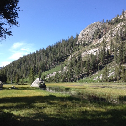
The next several miles the trail descended alongside Bubbs Creek, through Lodgepole pine with little meadows and patches of wildflowers. Around noon I reached a trail junction, with the PCT turning right up a steep slope and another trail continuing down stream, I guess out to the roads that come in from the west side of the national park. This was the beginning of the climb up Glen Pass. The trail climbed up through forest and talus with the deep call of Sooty Grouse to a hanging valley, where at another junction a trail headed east toward Kearsarge Pass, which is another common route out to resupply in One of the Owens Valley  towns. The PCT passed above Charlotte Lake, a beautiful blue below pale mustard peaks, then climbed into a crazy landscape of geological turmoil. It looked like the glacier had just melted away last week, and the mountain had only been uplifted the week before. Very large forces are at work here. Moraines of giant boulders rise above little tarns with rocky shorelines. The seems to be no soils anywhere yet, just big rocks. The trail is well graded and impressively built up the head wall of the pass, then follows the narrow ridge for a hundred feet before plunging steeply down the north side. This is tough going, with big steps down and lots of fist sized rock all over the trail. 

Looking north from Glen Pass into Rae Lakes basin.

Again, as when crossing Forester Pass this morning, the landscape and geology are very different on the north side of Glen than he south. There is much more color in the rocks now, with whole mountainsides rusty and stiles with white and black veins of some other rock. Down below are the Rae Lakes, a very popular place to go backpacking for 4-5 days. Up above is a bench like bowl called the 60 Lakes Basin, which sounds like a great place to go check out. Down along the lake shore there are lots of people setting up camp or enjoying hanging out by the water. Trout weave back and forth in the clear water, and a big lenticular cloud continues forming right overhead. I run into a ranger and ask him about mosquitoes down lower where I'm headed, and he says they just got bad. I decide to stop and eat dinner up here where it's windy and a bit cooler, then hike further down tonight and hopefully arrive at camp just after dark when the bugs will hopefully be asleep.

Upper Rae Lake

I stop along the shore of Arrowhead Lake, take a quick swim in the cold water, then start cooking. I have to wear long pants and rain jacket against the mosquitoes, but the view across the lake to high granite peaks and domes on the other side more than make up for the bugs.

After dinner and a bit more trying to catch up on journaling I start down a steep sided canyon toward Woods Creek. The lenticular cloud that had been overhead all day is now turning garishly red and pink as the sun sets. It seems like something from science fiction. Around dark me and a deer give each other a good scare, then a mile or so later I get to the Woods Creek crossing and find a couple thru hikers sitting around a humble fire. They are Dub Step and Splob, and they are tons of fun to hang out with and I end up staying up until 10:30.

Lenticular sunset.

Birds. 
Rock Wren
American Pipit 
Clark's Nutcracker 
Fox Sparrow 
Oregon Junco 
White-crowned Sparrow 
Wilson's Warbler 
Yellow-rumped Warbler 
Cassin's Finch 
Hammond's Flycatcher 
Hermit Thrush 
American Robin 
Ruby-crowned Kinglet 
Brown Creeper 
Olive-sided Flycatcher 
Sooty Grouse

June 20. Day 50.

Mt. Whitney summit to about PCT mile 777.75.
Miles hiked: 19.25.

Had a fitful night sleep, probably owning mostly to the altitude but also the hut getting really warm then sort of cold. Having been mostly awake from about 3 onward, I was a bit surprised to be woken up by voices outside just before 5. The sunrise was just starting to redden the eastern horizon and I quickly gathered my coffee making supplies and dashed out to near the edge of the steep eastern edge of the peak where a half dozen people were already sitting. I took my place and boiled water and enjoyed a magnificent sunrise. There were some good clouds out east, and these put on a perfect show. But what interested me the most was looking north, west, and south to watch the range of light do its thing. So many mountains and just a huge amount of rugged country! Some of it calls to me to come explore, while some of it looks forbidding and downright scary. I spent about 2 hours enjoying he view and talking to a few other PCT and other hikers. A couple next to me quietly got engaged. It turns out it wasn't a total surprise; he had given her the ultimatum that he wouldn't propose until she finished the JMT. Pretty doggone romantic.


Looking south and west, with the stone hut and the shadow of the mountain way out on the haze.

Now looking north.

Around 7:30 I packed up my bed and started back down the hill. Now there were plenty of people to pass, in contrast to last night when I didn't see anyone from a bit above Guitar Lake to the summit. There were lots of day hikers from Whitney Portal, and also some of my new thru hiker friends. I got a bit more water at Guitar Lake then strolled down to the ranger station to retrieve the food I left there and finally eat last night's dinner (didn't want to carry the water up the mountain). I compared foods with an older Korean man. He said he is doing 3 different 4-5 day trips along the JMT this summer. I said that sounds like a good summer and he said that since he's retired every summer is like that. He said that now the JMT is his job. Not too bad.

I finally got walking around 1:30, the big dinner heavy in my gut forcing me to start slowly along the few miles to rejoin the PCT at mile 767. Once back on the trail proper, things picked up nicely. The trail wrapped around a Lodgepole pine-forested ridge, traversed a bit, then dropped down to Wright Creek. There I met Huarache, Pocahantes, and Brother John. Brother John is Huarache's brother, named John, joining him on the trail for a week or so. Good trail name. More fun hikers I hope to hang out with more if schedules align. We leapfrogged the next few miles, climbing up through more forest past the lower end of the Wright Lakes basin which looks like a good place to go back and explore, hen up onto the stunning Bighorn Plateau. This is a high Rollin meadow of sorts, bare of trees, and with a little tarn at one end sparkling in the sinking sun. I had heard of and seen photos of this place before, and it was a place I was really looking forward to seeing. It didn't disappoint! Such an amazingly beautiful place, with that big open ground and huge mountains and deep canyons all around. 

Bighorn Plateau, looking south. Whitney is that big honker on the left.

Next down in to Tyndall Creek, a raucous little river tumbling over rounded granite. I considered staying here for the night, but since it was only 6:30 and I'm on a bit of a schedule to meet Libby at Vermilion Valley Resort, I decided to continue on a few more miles. The Tyndall Creek valley open d I to another big, broad, gently sloping meadow several miles across. It rivaled Bighorn Plateau and along with it ranks as some of the most spectacular parts of the Sierra I've been to. The setting sun warmed the basin and high peaks all around it, and I was in hiking bliss.

Looking back down Tyndal Creek.

A little after sunset, as the trail climbed up through rocky country past a few wide shallow tarns, I found a small bivy site tucked up and hidden away in rocky outcrop. I set up camp and made dinner while a magical alpenglow show played on a big peak to my south east that's just off my maps. What a day!

My bedroom for the night.


Birds:
Gray-crowned Rosy-finch
Rock Wren
American Pipit
White-crowned Sparrow 
Mountain Chickadee 
Hammond's Flycatcher 
Yellow-rumped Warbler 
Brown Creeper 
Oregon Junco 
Clark's Nutcracker 
Stellar's Jay 
Northern Flicker 
White-breasted Nuthatch 
Ruby-crowned Kinglet 
Hermit Thrush
Cassin's Finch 
American Robin