A hike on the Pacific Crest Trail

Hi everyone. This blog will chronicle my walk along the Pacific Crest Trail. Snoop around and find out about who I am, why I'm doing this, what I'll be bringing, and follow along as I hopefully make it all the way from Mexico to Canada.

Thursday, April 30, 2015

April 27. Day 9.

Warner Springs to near Trail Angel Mike's place (PCT mile 127)
Miles hiked: 17.5

Last night started out very dewey, and since I was sleeping without the tent up I had heavy condensation all over my sleeping bag not long after laying it out and getting in. I toweled the bag off as much as I could and draped the tent over me. However, at about 4:30 a tremendous east wind picked up suddenly, and I quickly put all my "heavy" stuff over my light stuff to keep everything under control. The next couple of hours were a bit chaotic. Peoples' tents where blowing down left and right, dust and leaves were blowing inside my sleeping bag and everything else, an empty 5 gallon water jug tumbled right by me, and a lawn chair was headed my way before it got tangled up in a faucet. All anyone could do was get as much of their stuff under control as they could, count on the fence downwind of us to catch everything else, and hunker down to wait it out. Eventually things calmed down around 7:30 and people could wander around and collect their missing items.

Starting at 8, everyone cycled back through the community center for breakfast of eggs, sausage and pancakes. I tried to figure out my phone/photo issue, but the computers in the center didn't like my wireless flash drive to be plugged in to them and I didn't get anything figured out. Towards the end of breakfast some of the volunteers started shuttling hikers back and forth to the post office to pick up resupply boxes. I got mine and repacked my pack, and was on the trail around 11.

There goes the trail. The hills up there in the distance are where the last photo in this post was taken.

Big valley live oak.

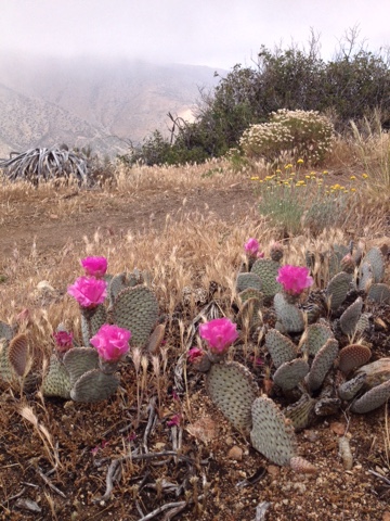
It would have been good to be a bit more efficient with my morning chores, because it soon became apparent that the weather had shifted back to what we all expected of the desert. The trail headed out from Warner Springs across an open field with more Lark Sparrows, then went in to a grove of amazing valley live oaks. Some of these trees were huge, and the microclimate in this grove was substantially cooler than out in the open. We crossed hwy 79 again, then zigzagged up a canyon with more oaks and some very nice sycamores, and it had running water! I filtered 2.5 liters at the last stream crossing before the trail left the canyon. It was 12 miles to the next water. Now the trail began climbing up through chemise and manzanita, traversing up a southwest-facing slope that was exposed and hot. This climb seemed to go on forever, with countless false passes where it looked like we were nearing the top, but in fact had much more to go. It wasn't terribly hot, somewhere in the upper 80s I think, but after the last few cool days none of us were quite ready for this climb in the heat of the day. There was thankfully a slight breeze here and there, but in other places it was still and stuffy. It took me about 4 hours to do this climb, including a break in the shade which really helped this creature of the fog belt.

Eventually the trail leveled and traversed around the top of a big, bowl-shaped drainage full of big pink granite boulders and a few scattered pines amongst the scrub. Black-headed Grossbeaks were surprisingly abundant out in this dry scrub.

Warner Spings is down in the valley. Came from the hills on the far side the last 2 days.

Eventually around 6 I got to the next water source at Trail Angel Mike's place. I don't know much about this place, but it is just a single house way out in the scrub on a hillside. There are water tanks which hikers can fill their bottles from, and apparently people can camp in the back yard too. I was feeling like I needed some alone time, so after getting my water I walked just another few hundred yards and found a flat spot between some short chemise. It was really nice to just sit and clean my feet and watch the sun's last light and listen to California Thrashers and Wrentits singing. I also got to enjoy a bit of scotch some other hikers have me; someone put a whole bottle in their resupply box!

Birds:
Barn Owl (BNOW)
Horned Lark (HOLA)
American Crow (AMCR)
European Starling (EUST)
Acorn Woodpecker (ACWO)
Western Scrub-jay (WESJ)
Oak Titmouse (OATI)
Western Bluebird (WEBL)
Lesser Goldfinch (LEGO)
Bushtit (BUSH)
Northern Flicker (NOFL)
Bewick's Wren (BEWR)
Pacific-slope Flycatcher (PSFL)
California Towhee (CALT)
California Thrasher (CATH)
House Wren (HOWR)
Black-headed Grosbeak (BHGR)
Spotted Towhee (SPTO)
Ash-throated Flycatcher (ATFL)
Black-chinned Sparrow (BCSP)
Orange-crowned Warbler (OCWA)
Western Wood Pewee (WEWP)

April 29. Day 11.

PCT mile 146 to Mountain Fire Detour mile 3.6
Miles hiked: 20.2; +2 miles round trip for water, food and beer.

~~~~~~~~~~~~~~~~~~~~~~~~~~~~~~~~~~~~
First off, to all those of you who have posted comments, THANK YOU. It's a bit too much screen time for me to reply to them all individually, but I do read and appreciate them all, and it's great to know folks out there are enjoying reading along as I make this hike.
~~~~~~~~~~~~~~~~~~~~~~~~~~~~~~~~~~~~

Well that was a birthday to remember. I woke up and got hiking a bit before 6, but was quickly distracted by 2 big ants fighting in the middle of the trail. I watched for 8-10 minutes, but it wasn't even clear who was winning, and it looked like the sort of thing that could go on all day, so I got back to hiking. The trail led through more dry scrub, down and back out of a canyon, and along some fantastically-eroded cliff faces. As we climbed the last hill before hwy 74, I got a great birthday bird, a Gray Vireo. I listened to him singing for a few minutes, and got a good enough look to know it was a super gray colored video. 2 lifers in 2 days; good birthday present!

The destination for this morning was the Paradise Valley Cafe, a super hiker-friendly place a mile from where the trail crosses highway 74. This is also the next place for hikers to get water. I got there around 8:15, just behind You Again and Angie, a couple I've been leapfrogging the last 2 days. We all shared a table, and I got down to business having a proper celebratory breakfast. I started with a milkshake, then had an omelet with ham, bacon, and guacamole. Then I got what I had really been wanting for birthday breakfast: a beer. I got a double IPA named something like Rowdy Bitch, and liked it so much I decided to have a second. It wasn't until 11 that I had finally finished the beer, paid my tab, filled up on water and got back to hiking. I was feeling pretty cheery and relaxed at this point, and stopped to chat at the trailhead with a few other hikers who were waiting for a ride to the cafe. 

9:33- breakfast beer #1.

10:02- breakfast beer #2.

By the time I got started up the actual trail it was getting pretty hot. I made it about an hour before my nose started bleeding; not too surprising in this dry weather. I sat down in the shade of a big boulder to let it stop, and before I knew it I was waking up an hour later from a great nap!

I had a snickers (everyone else is doing it) and kept hiking. The trail climbed up from the dry scrub into a dry live oak and pine (2 inch needles in clumps of 4 and 5, but it doesn't seem to match anything in my app), with big orangey granite outcrops. The Mountain Chickadees here have a slightly different song than the ones back on Mt. Laguna. Here they still have the two notes to the first part ("chee-eese"), but there is an emphasis on the second note. 

I had another break in the shade mid afternoon, again to let my nose get itself under control, and to cool down. The trail continued climbing up into country that reminded me in some ways of a miniature version of the Sierra, at least the lower elevation parts, with oaks and pines and granite and steep trail with big steps and long views. Except in this case the views were not of more big granite peaks, but rather down out of the mountains, to some barren hills, the eventually to the extravagant green of the greater Palm Springs area, and finally back up into the hills and mountains of Joshua Tree NP. I saw 3 domestic-type goats near some stagnant water, but they didn't answer when I asked what they were doing there.

Eventually the trail reached the ridge top and traversed this for 3-4 miles. By now m Achilles' tendon, which had started to bug me first thing this morning, was getting pretty sore from all the climbing. Achilles tendinitis is one of the more common thru-hiking overuse injuries, so this was a but worrisome. I planned to get as far as I could tonight, then have a relatively shortish hike to Idyllwild tomorrow. The only complication to this plan is that the 10 or so miles of trail up and just after Idyllwild are still closed to let plants regrow after the 2013 Mountain Fire. To get to town now, hikers can either hitch hike or road walk along highway 74 (total mileage ~17), or can hike up the PCT to mile 163.6, then take a steep side trail back down to 74 only about 10 miles beyond Paradise Cafe, then rejoin the road route (~24 miles). It seemed that hikers were split about 50/50 on these 2 options, and I decided to take the trail route because I still had plenty of food and want to see the start of the San Jacinto Mountains. It was actually pretty neat being up on that trail that's getting less use than the PCT thus far. The trail was a bit overgrown and less-well maintained, and I cod sort of pretend there were far fewer people overall doing the hike.

Looking east off the ridge.

And west.

I ate dinner at the junction where the side trail drops back down to the highway, again using my tent stake because in my celebratory state I'd forgotten to get a to-go spoon from the cafe. After sort of cleaning my pot I put my shoes back on and started down the tightly-packed switchbacks which delivered me in just over a mile about 1,200 feet back downhill. The detour involves a mile or so of paved road, and this really started to get my Achilles in a bad mood. Luckily I still had a bit of the scotch from the hikers in Warner Springs to help ease the pain. Next the detour involves a dirt forest service road, and I made it to this right around dark so found a flat spot not too close to any cacti, washed feet and legs, had some ibuprofen, and was quickly asleep.

Paintbrush and metamorphics.

Birds:
California Towhee
Bewick's Wren 
Ash-throated Flycatcher 
Common Poorwill 
Black-headed Grosbeak 
Western Scrub-jay
Oak Titmouse
Gray Vireo*
Mountain Chickadee 
Bushtit
Canyon Wren
Wilson's Warbler
Northern Flicker
Mountain Quail 


April 28. Day 10.

PCT mile 127-146.
Miles hiked: 19; + ~1/2 m round trip to get water off trail.

I've spent quite a few nights under the stars, including in some places pretty far removed from light pollution. But last night's stars were quite a show in this very clear, dry air, even with the super bright half moon. The Milky Way was perfect, and this was actually the first night of the trip I've seen the North Star. As I drifted in and out of sleep through the night, I watched the Big Dipper progress on its trip through the sky, beginning upside down in the east, and ending right side up before sliding beneath the western horizon just before dawn. A Common Poorwill had ben calling through the night, and as I was packing I saw one fly in and plunge into the scrub only about 40 meters from me, I suppose to roost for the day.

I got moving around 5:25 and was hiking a bit before 6, with my coffee and breakfast snacks to go. For 2 miles the trail climbed the side of Combs Peak. It was a gorgeous plain sunrise, no clouds to complicate things, just empty sky shifting through various shades of orange. The habitat was more of the same dry scrub from yesterday, the sort of stuff the seems like it will burst into flame if you just talk too loud around it. I could tell I was the first hiked up the trail this morning by all the spiderweb I had to break through. Lazuli Buntings where singing here and there.

Here comes the heat!

After the 2 miles climbing the trail began what ended up to be an 11 mile descent down from the dry scrub into even drier cactus/sparse shrub. Unfortunately the app I have isn't very good for shrubs so I'm not entirely sure what I'm walking through. Around the transition between thee habitats a Scott's Oriole was singing, all yellow and proud on top of a bush. I'm pretty sure I've never seen this species before!

Will be in those far mountains tomorrow.

I reached the Tule Spring water tank (PCT mile 137, plus a .25 m spur trail) just before 10. This was a beautiful spot with cottonwoods growing in a tight canyon. My brunch and water filtering break took a bit longer than planned owing mainly to the fact that I lost my spoon and had a heck of a time using a tent stake to herd the granola to the edge of my cup so I could slurp it up. I made 4 L for the 15 miles to the next water. I'm back to budgeting a liter for every 5 miles, which is about twice what I was using during last week's cool weather. I've also determined that about 1 extra liter is what I need to comfortably dry camp (dinner, cleaning dishes and teeth, a bit to drink, morning coffee), and I was planning to camp tonight somewhere just before the next water.

I hiked another hour then set up to take siesta in Nance Canyon (PCT 140), but I seriously mis-judged which way the shadow of a nice cottonwood would travel, and spent the next 2 hours dodging sunbeams. I cooked my dinner  cous cous with tomato powder, freeze dried chicken and asparagus, other veggies, and Italian seasoning, so I didn't have to carry that water any further. I managed to get the consistency of this meal just right so I could get bite sized scoops with the tent stake. Probably the best thing about this sort of failed siesta was the Oak Titmouse nest in the cottonwood, with both parents busily bringing food to the nestlings.

I was done chasing shadows and left Nance Canyon around 2. The afternoon turned into a pretty hot slog through dry sparse scrub. The birds up here were sensibly still on siesta, and I just trudged along under my umbrella looking at the occasionally surprisingly bright red or yellow prickly pear flowers. Now and then, to keep things interesting, I had to do umbrella battle with wind gusts.

I only made it another 4 miles before I had to retry a siesta amongst some beautiful big boulders out on a little point of land overlooking a valley where we think the town of Anza lies. This siesta went much better, and I spent almost another 2 hours in be shade of a rock, with a nice breeze, laying on my back with feet up on the rock. At 6 I hiked on another 2 miles, to a little camp on another little point of land overlooking the same valley. I had a little wet wipe bath to get some trail grime off, then munched I. Snacks while the lint faded and coyotes and dogs yodeled and barked at each other. Right before dark, a slight west wind picked up and a  of smog moved east into the valley. It was pretty dramatic to see the distinct boundary between 2 air masses, and to think about how everything is connected to everything else. The exhaust from the car that drove me to the trailhead is now clogging my nose on the trail.

Peaking out between boulders at siesta spot #2.

Birds:
Common Poorwill*
Wrentit
Black-chinned Sparrow
Western Tanager
California Thrasher
Western Wood Pewee
Spotted Towhee
Ash-throated Flycatcher 
Bushtit 
Black-headed Grosbeak
House Wren
Townsend's Warbler 
Lazuli Bunting*
Mountain Quail 
Western Scrub-jay
Scott's Oriole*
Song Sparrow 
Rock Wren

Monday, April 27, 2015

April 26. Day 8.

Barrel Spring to Warner Springs (PCT mile 109.5)
Miles hiked: 8.4

With just a short hike in to Warner Springs today, and needing to wait until tomorrow to get my resupply box from the post office, I planned on a relaxing morning. Luckily the weather was greatly improved, and I lounged around in the sun, letting all my stuff dry, until about 11. A Pacific Slope Flycatcher and several other birds were very busy in the big valley live oaks around camp.

I started hiking slowly, the trail wandering up over little scrubby hills then down through flat little valleys with short straw-colored grass that smelled of cow but had only ground squirrels and ants doing their little squirrel and ant things. For about 100 meters a California Sister butterfly drifted along the trail a few feet in front of me. Cliff Swallowed circled overhead. Lark Sparrows sang for the tops of oaks, and Horned Larks did their little twinkling noises out in the grass.

Around mile 104 a was walking along, minding my own business, when all of a sudden right there next to the trail was a clean, clear, burbling stream. This was the first natural water (not counting rain) since about mile 28 on day 2. I was startled, and actually said out loud "whoa!" I took a break in the shade of a giant sycamore to reapply sunscreen and regain m composure. I got both accomplished just before two people came by on horses.

Next I passed Eagle Rock, which is just what it sounds like, spanning about 15 feet tall and 35 feet wide. Actually, based on bill size and posture, I think it looks more like a Turkey Vulture with its wings spread out in the early morning. But I didn't tell anyone that since I didn't want to seem unpatriotic. I'm still having phone issues so no photos, but this is one of the most photographed landmarks along the trail, so you should be able to find a picture and decide for yourself. The final mile or 2 into Warner Springs were along a lovely little creek with giant valley live oaks, some 4 feet across.

Once into Warner Springs I found my way to the community resource center where volunteers do a great job taking care of hikers. I started out with a double cheeseburger (finally did what'll those Mt Laguna chickadees were telling me to do), then did some laundry in the outdoor shower, talked to Libby, and finally spent the rest of the afternoon and evening hanging out with all the other hikers here. There are about 40 or so others here, and most of the other people I have hiked or camped with are here, so it's been pretty fun.

Birds:
One week in and I'm up to about 71 species.
OATI
PSFL*
ATFL
ACWO
GHOW
TOWA
BUSH
CORA
NEWR
LEGO
WIWA
WCSP
WREN
CATH -really good look today, it was acting like a CALT
SPTO
CALT
MODO
CAQU
CLSW*
LASP*
WETA
RTHA
WEME
HOLA*
EUST
HUVI*
LEGO
WEBL
YRWA
RSHA
AMCR
LEWO*
SAPH*
TUVU
Great-tailed Grackle 

Sunday, April 26, 2015

April 26. Day 8.

Barrel Spring to Warner Springs (PCT mile 109.5)
Miles hiked: 8.4

With just a short hike in to Warner Springs today, and needing to wait until tomorrow to get my resupply box from the post office, I planned on a relaxing morning. Luckily the weather was greatly improved, and I lounged around in the sun, letting all my stuff dry, until about 11. A Pacific Slope Flycatcher and several other birds were very busy in the big valley live oaks around camp.

I started hiking slowly, the trail wandering up over little scrubby hills then down through flat little valleys with short straw-colored grass that smelled of cow but had only ground squirrels and ants doing their little squirrel and ant things. For about 100 meters a California Sister butterfly drifted along the trail a few feet in front of me. Cliff Swallowed circled overhead. Lark Sparrows sang for the tops of oaks, and Horned Larks did their little twinkling noises out in the grass.

Around mile 104 a was walking along, minding my own business, when all of a sudden right there next to the trail was a clean, clear, burbling stream. This was the first natural water (not counting rain) since about mile 28 on day 2. I was startled, and actually said out loud "whoa!" I took a break in the shade of a giant sycamore to reapply sunscreen and regain m composure. I got both accomplished just before two people came by on horses.

Next I passed Eagle Rock, which is just what it sounds like, spanning about 15 feet tall and 35 feet wide. Actually, based on bill size and posture, I think it looks more like a Turkey Vulture with its wings spread out in the early morning. But I didn't tell anyone that since I didn't want to seem unpatriotic. I'm still having phone issues so no photos, but this is one of the most photographed landmarks along the trail, so you should be able to find a picture and decide for yourself. The final mile or 2 into Warner Springs were along a lovely little creek with giant valley live oaks, some 4 feet across.

Once into Warner Springs I found my way to the community resource center where volunteers do a great job taking care of hikers. I started out with a double cheeseburger (finally did what'll those Mt Laguna chickadees were telling me to do), then did some laundry in the outdoor shower, talked to Libby, and finally spent the rest of the afternoon and evening hanging out with all the other hikers here. There are about 40 or so others here, and most of the other people I have hiked or camped with are here, so it's been pretty fun.

Birds:
One week in and I'm up to about 71 species.
OATI
PSFL*
ATFL
ACWO
GHOW
TOWA
BUSH
CORA
NEWR
LEGO
WIWA
WCSP
WREN
CATH -really good look today, it was acting like a CALT
SPTO
CALT
MODO
CAQU
CLSW*
LASP*
WETA
RTHA
WEME
HOLA*
EUST
HUVI*
LEGO
WEBL
YRWA
RSHA
AMCR
LEWO*
SAPH*
TUVU
Great-tailed Grackle 

April 25. Day 7.

Near PCT mile 72.6 to Barrel Spring (PCT mile 101.1)
Miles hiked: 28.5

Well, today was a bit of a character-building day. I woke up around 4 this morning with some anxiety about the day's hike. I had pretty much committed to skipping the hitch hike in to Julian where I could refill water and take advantage of the rumored free pie. This meant that if I didn't want to rely on water caches, I had to make it all the way to Barrel Spring on the 5 liters I had left from the Rodriguez Spur tank. I've been using much less water than I anticipated, and I figured that with the cool weather I should be able to make that push OK. But the big unknown was how my body, and especially my knee, would handle all those miles, potentially all in one day.

I set out around 5:45, right around when it was light enough to get back to the trail without stumbling into a cactus or yucca. It was partly cloudy but still quite windy, with gusts up to about 30 mph. But it was a spectacular morning! As I followed the trail down off the flank of Granite Mountain and out into the flat San Felipe Valley, the sun slid up into the gap between distant mountains and cloud and set everything aglow. Rocks, century plant flowers, the shaggy little junipers I was now seeing, all were set alight in their own particular shade of warm orange. There was even a partial rainbow in the west off toward Julian. A Loggerhead Shrike scolded me as I passed.

San Felipe Valley sunrise.

I passed Sprout in her windblown little bivy, and eventually made it to Scissors Crossing, where the trail crosses hwy 78. A big tumbleweed and an occasional car passed by, and I didn't linger long.

The ants around here have been very busy collecting these seeds which are piled up outside their holes.

Climbing up the south-facing slope of the San Felipe Hills, I was immediately into a new habitat. The scrub, yucca and prickly pear cactus of the north-facing slope of Granite Mountain were now replaced with barrel cacti, very abundant century plants, and the strange creosote bushes, with their skinny, leafless stocks topped with little red flower clusters. House Finches, Cactus Wrens, Anna's Hummingbirds, and a woodpecker I didn't quite get a good look at were all out and about as the trail switchbacked up into drier and drier country.

So deserty.

Eventually the trail leveled and traced in and out of countless hidden canyons as it wrapped from the south face of the SF Hills around to the western slopes. I brunched at 10:30 at PCT mile 84.7, adding 2 peanut butter packs to my granola for a shot of around 700 calories. Next the trail climbed slightly higher into a very desolate-seeming landscape, which apparently had burned sometime recently. But even here, where at first glance the only sign of life was  the charred remains of century plants and shrubs, upon further examination one could observe Black-chinned Sparrows and Rock Wrens feeding fledglings. The chicks of both species were pretty damn cute, all fluffy and clumsy and naive perching right in front of me.

Looking back down the trail from the San Felipe Hills, down at the valley and mountain on the other side where I started this day.

As I continued to the NW, the wind increased and clouds darkened. The approach to the turn off to the 3rd Gate water cache was a bit exciting, as the trail traversed a steep slope about 1000 feet above the valley below, and gusts up to about 45-50 mph peppered me with little raindrops and pushed me sideways (luckily uphill).

I got to 3rd Gate (PCT mile 91.2) around 1:50, and had a little rest with Avenger, someone who doesn't want to be Big Country, someone who doesn't want to be Anakin, and Pilgrim (hiked and camped with him night 2). Sprout showed up shortly after I did, and around 2:10 we all set out to tackle the next section. Just as we were leaving a couple arrived and said it was forecast to rain more tonight, and in retrospect this could have been a good time to have a more-careful gander at the map and re-evaluate our plan to push on a few more hours. For the next couple miles the trail made ridiculously lazy switchbacks (Sprout was a quarter mile ahead of me, and a few times when we passed each other we were only about 50 vertical feet apart) up the east side of a ridge, and we were somewhat sheltered from the weather. Eventually however we rounded to the west side of the ridge to find the storm had arrived. We were on the same steep slope as before 3rd Gate, but now the winds were gusting up into the 60+ mph range. I had been feeling a bit slow before, but now the wind and building rain provided all the incentive I needed to pick up the pace. We formed a bit of a train, nose to butt, pumping trekking poles, and trying to stay upright and on the trail. At mile 94-ish we had a little break and discussed our options. I'm not sure if I was the only one of us who could read a topo map, or just the only one who had the map handy, but I became the unofficial navigator, checking the map to see when we would switch back the east side of the ridge and maybe find a sheltered spot to camp. It looked like the the former would happen around mile 96, and the latter might come along a mile or 2 after that.

About now it started to actually rain (not just heavy sideways mist), and we kept up the pace to try and stay warm in our little hiking clothes and semi-functional desert rain jackets. Pilgrim took a little bivy spot just past mile 96, and the rest of us took a little break at Billy Goat's Cave (a little human-made cave carved into a rock face; PCT 96.1) then decided to just push all the way to Barrel Spring. We tromped on past the 100 mile point of the trail. My phone storage was full so I didn't get any photos. Somewhere along here I also saw Wrentits feeding fledglings.

We got to the spring at 5:45. I was a bit ahead of the others, but I knew Sprout and Avenger had pretty minimal tarp shelters so I waited for them to pick the most sheltered spots to set up. I set up my tarp, helped Sprout a bit with her's (while a turkey wandered through camp), made sure Avenger was good to go, then dove under cover.

My dinner cooking attempt was a comedy of errors. First I burned a batch of polenta far beyond edibility. Luckily I was camped on coarse sand, so after scraping that disaster into one of my water bottles I was able to scour the blackened crust out without leaving bed. Next I tried some curry lentil soup, but that was too spicy with all the dried jalapeƱo I had included. My water bottle was too full so this went into a ziplock. Defeated, I just snacked on jerkey and cookies.

My body handled the miles pretty well today. My knee never really had any pain, my ankles got a little sore, and I got just two baby blisters that are really too small to show to any other hikers.

Cold rain in the desert, go figure.

Birds (might be forgetting a few because weather prevented notebook use)
*= new for trip
CALT
SATH
LOSH*
WETA*
TOWA
Sage Sparrow 
CAWR
HOFI
ANHU
OCWA
BCSP
WREN
WESJ
ATFL
GCSP*
MOQU*
WITU
Un-ID woodpecker 
Un-ID shorebirds flying by over San Felipe Valley; best guess is American Avocet or Willet- didn't get the Hubble on it, just saw black and white go zipping by.

Saturday, April 25, 2015

April 24. Day 6.

Pioneer Mail Trail Head to about PCT mile 72.6
Miles hiked: 20.

Today had a fair dose of type 2 fun scattered throughout. My prediction that it wouldn't really rain too much overnight proved to be quite wrong indeed. It rained all night, and continued to be a bit nasty all day.

Let's start at the beginning: I woke around 4 to find that my backpack (which goes under my feet at night), a corner of my ground cloth and sleeping pad, and the foot of my sleeping bag were sticking out from under the edge of my tent, as a result of me slipping down the slight slope I was camped on. So those things were all a bit wet. It also appeared that I now have a slow leak in my pad. I rearranged everything back under the tent, dried things off a bit with my little square of pack towel, and blew my pad back up. I didn't get much more sleep though, because there was also a fair bit of condensation inside the tent since I'd pitched it with the windward edge on the ground to keep the wind out, and every time the wind hit the walls, a fine sprinkle would rain down on my face.

I decided to get moving a bit after 5, making coffee from bed, munching on a bit of jerkey, getting my on-trail breakfast (3 bars) ready, and slowly packing my stuff. My packing was a bit slow as I figured out which order to do things in to keep the most stuff as dry as possible. I stayed under the tent until the very end, and it was the last thing to be packed. I shook as much moisture off it as I could, then stuffed it in the outside pocket of my pack.

I said hi to Sprout who was also just getting out of bed, filtered another two liters from the nice faucet right next to the pile of silly water jugs, then got walking. Boy was it chilly! It was about 45 degrees, and the wind was steady 30-40 mph and gusting to at least 50 in certain places. There was cloud all around and I was getting sprayed by sideways mist. I didn't realize quite how bad it was when I was packing up, so I only had my light running shorts, hiking shirt, rain jacket, and wool neck muff up around my ears. Pretty quickly I realized this wasn't quite enough, so I stopped in the lee of a big rock face and put on my new wool boxers, which gave a bit more warmth to the most sensitive areas. I had to put some Antarctica skills to work to prevent various pieces of gear from blowing away.


Felling much more insulated, I continued on. According to the map the trail was still tracing the scarp of the mountain that I walked along most of yesterday, but I couldn't tell because visibility was only about 100 meters. After an hour or so the light mist turned to actual rain, and I think the wind speed bumped up 5 or so mph. At times like these I believe it's important to at least pretend you're having fun, even if you really have no right to be. In this spirit I let out a hoot and shouted "now we're really living!"

There were several Townsend's Warblers up here in the scrub and storm, being blown around like bits of candy wrapper. I would have sent them in the direction of the nearest copse of trees if I had any idea which direction that was. I also looked up just in time to see my first American Kestrel of the trip go shooting by on the wind.

It took me about 3.3 hours to go the first 10 miles, which was my fastest bit of walking so far on this trip. I'm not sure if my pace was much faster than previous days, but owing to the wind and cold I was stopping less to look at birds and take pictures of flowers. I had brunch at this 10 mile point, sitting in the lee of a bush with my down jacket around my legs and the umbrella open in front with the handle stuck between my legs. Brunch was granola with powdered mild and peanut butter, and a second cup of coffee, this time cold

Brunch under bush.

After this the trail got serious about going down hill. Today was going to be the first day with a lot of downhill, and I dropped it in to low range 4-heel drive (feet and trekking poles) to go slowly and play nice with my knees. 30 or so minutes later I was a mile farther along, about 1000 feet lower, and the temperature was about 15 degrees warmer, but it was still pretty windy. I had dropped down out of the cloud into a big, rugged, remote, classically Western landscape. There were even gun shots about a mile away. The map shows a bunch of mines in the area, so the most likely explanation was that two neighbor miners were having a shoutout over one of the claims. Either that or there was a stage coach holdup in progress.

Beaver tail cactus.

I think this one's a type of prickly pear.

Not in my nature app. This one only showed up once I got down lower and drier.

Hedgehog cactus??

The trail side-hilled around a ridge then dropped into a lower and drier landscape. There were a couple new cactus species, and there was more bare dirt between the shrubs.

I can't get enough of these Yucca.

I made it to the next water source (Rodriguez Spur tank, mile 68.4) and met Ox and Plow (guess which one is slowing the other down). I spent about 1.5 hours there, eating, drinking, and chatting with most of the people I hiked or camped with yesterday as they arrived. This source is a cement tank which I guess is periodically filled by someone. People can either get water from a pipe downhill of the tank, or scoop water out of a hole in the top. Ox said he saw several headlamps, a water bottle, and a couple other unidentifiable objects in the tank when he was getting water from the top. There isn't reliable water on trail for another 33 miles, so I left this tank with 6 liters, which with the food I still have made my pack the heaviest it's been so far, probably about 33 pounds.

I hiked another 4 or so miles before wandering off trail and finding a flat and cactus-free spot to camp. It is still pretty windy and cloudy, but isn't really raining too much anymore. I set up my little camp, eat my little pot of mashed potatoes, write in my little journal, then drift off for a little sleep. I am in a big place.

There goes the trail, gradually on down this hillside.

Cold rain in the desert. Go figure.

Birds:
TOWA
OCWA
WESJ
CATH
SPTO 
BCSP
WREN
HOWR
CALT
AMKE
CORA